Pikes Peak State Park Loop 1
McGregor, IA
On our trips to Iowas we will often stop at Pikes Peak State Park to let Cash stretch his legs. One of my favorite loops is to start at the overlook of the Mississippi River and take Bridal Veil Falls Trail (I still haven’t seen the falls with water yet) to East Hickory Ridge Trail which we take out to another overlook of the river. We then follow the West Hickory Ridge Trail to the Weeping Rock Trail back to the parking lot. It is interesting that on the Bridal Falls and Hickory Ridge trails your can see (from a rspectful dstance) effigy mounds created by indigenous peoples.
Walk-Specific Map
Take Note
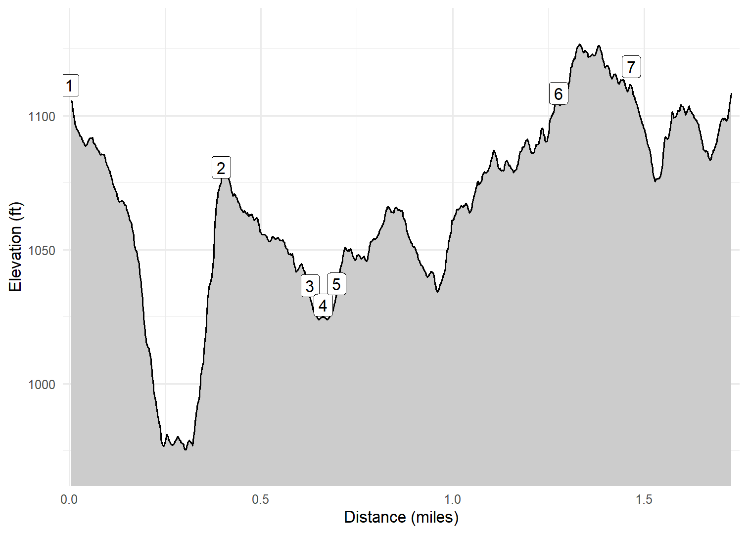
- Click on a segment to get specific information.
- Numeric labels correspond to the same labels in the elevation profile and summary information below.
Elevation Profile
Images

PKSBRDL02: Typical scenery Fall 2024

PKSBRDL02: Typical scenery Fall 2024

PKSBRDL02: Cash at Mississippi River overlook

PKSBRDL02: Typical scenery Fall 2023

PKSBRDL02: Typical scenery Fall 2023

PKSBRDL02: Effigy mound

PKSBRDL02: Mississippi River backwaters
GPX Download
A sanitized GPX file of our hike is here.
Summary Information
| NUM | trackID | Primary | Description | Type | Distance | CumDist | DeltaElev |
|---|---|---|---|---|---|---|---|
| 1 | PKSBRDL02 | Bridal Veil Falls Tr | Mississippi River Overlook to E Hickory Ridge Tr | Trail | 0.40 | 0.40 | -31 |
| 2 | PKSHKRYE02 | E Hickory Ridge Tr | Bridal Veil Falls Tr to Spur to Hickory Ridge Overlook | Trail | 0.23 | 0.63 | -44 |
| 3 | PKSHKRYE03 | E Hickory Ridge Tr | W Hickory Ridge Tr to Hickory Ridge Overlook | Trail | 0.03 | 0.66 | -7 |
| 4 | PKSHKRYE03 | E Hickory Ridge Tr | Hickory Ridge Overlook to W Hickory Ridge Tr | Trail | 0.03 | 0.70 | 7 |
| 5 | PKSHKRYW01 | W Hickory Ridge Tr | Spur to Hickory Ridge Overlook to Weeping Rock Tr | Trail | 0.58 | 1.28 | 71 |
| 6 | PKSWPNGR02 | Weeping Rock Tr | W Hickory Ridge Tr to E Hickory Ridge Tr | Trail | 0.19 | 1.47 | 10 |
| 7 | PKSWPNGR01 | Weeping Rock Tr | E Hickory Ridge Tr to Parking area | Trail | 0.27 | 1.73 | -2 |